
On the heels of receiving a Colorado Water Conservation Board grant, the Upper Arkansas Watershed Partnership met recently to begin developing the Upper Arkansas Watershed Resiliency Plan.
The grant funding will support the first phase of the plan, which involves stakeholder engagement, a needs assessment, and assessment of riparian and floodplain conditions in the Upper Arkansas Basin.
Components of the plan include:
- Stakeholder collaboration and community engagement.
- Assessment of existing studies and plans to determine data gaps that need to be addressed.
- Assessment of riparian and floodplain conditions along with fluvial hazard mapping.
- Assessment and coordination of local agriculture needs.
- Development of a work plan for the second phase of the resiliency plan project.
Marjo Curgus of Salida-based Del Corazon Consulting facilitated the Partnership meeting, which featured presentations by Mark Beardsley of EcoMetrics in Buena Vista and Michael Blazewicz of Round River Design in Salida.
Curgus stressed the need to develop a clear picture by the end of 2021 “of where we want to go with the next grant cycle,” and to achieve a common definition of problems in the watershed and how to solve them.
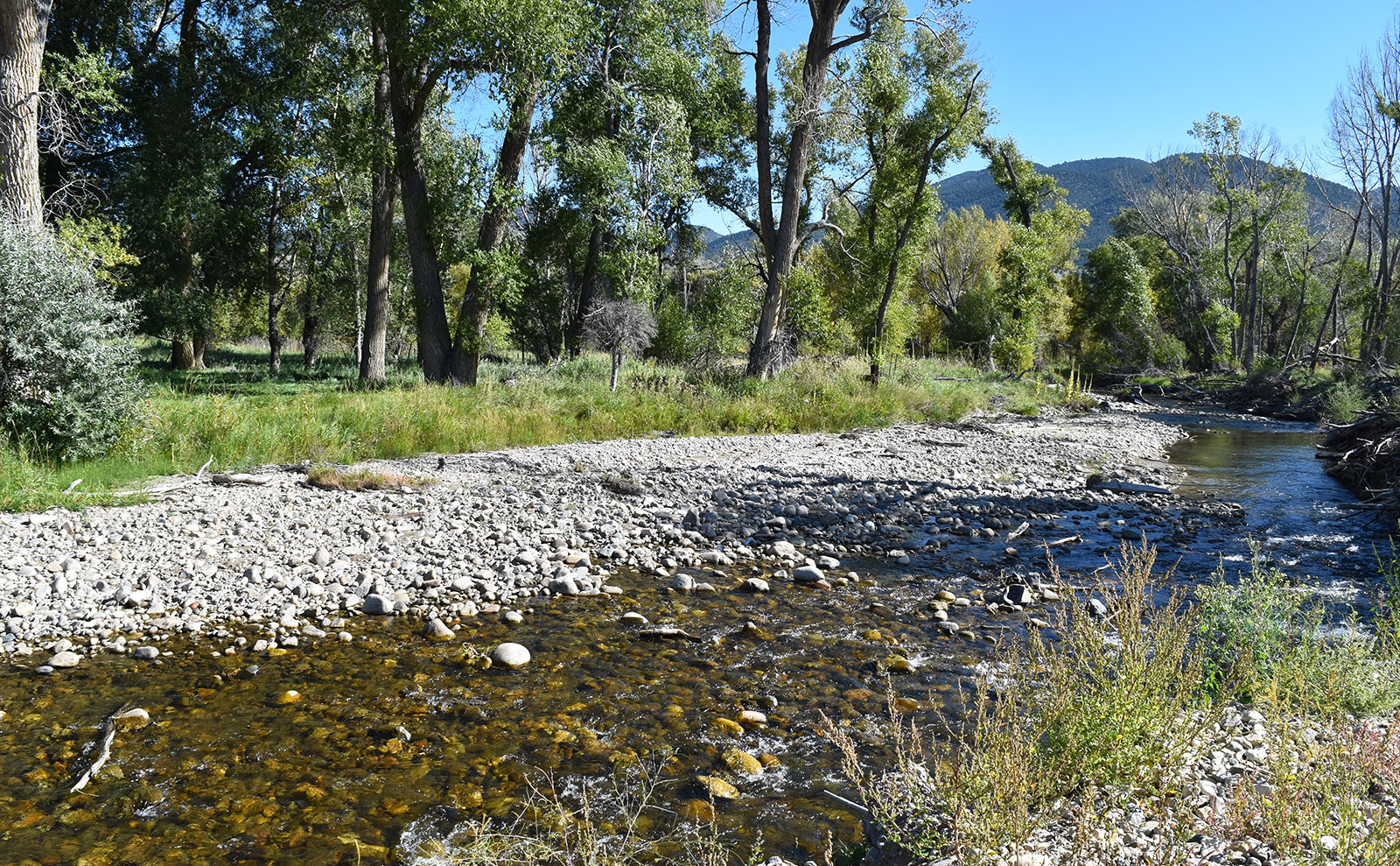
Beardsley and Blazewicz presented information from a stream health assessment they conducted on the 1-mile stretch of the South Arkansas River from County Road 107 to the Arkansas River.
Beardsley said stream health assessments establish a foundation for developing stream management plans, which are supported by Colorado’s Water Plan through grant funding.
He listed the nine components of the Colorado Stream Health Framework – components like flow regime, water quality, riverscape hydrology and riparian vegetation. These elements framed the South Ark assessment, which categorized the 1-mile stretch of the river into four segments, each of which received a stream-health grade.
The upstream segment just below CR 107 received a grade of C-. The next section, designated as the Vandeveer-Snyder segment, received a C. Next, the Lowry-Treat segment earned a C-, and the final segment from US Highway 50 to the Arkansas River earned a D+.
Beardsley said the grades show the inverse relationship between stream health and human impacts ranging from historical agricultural practices to new construction projects.
Blazewicz discussed fluvial hazard mapping, which uses lidar to reveal areas prone to the variable effects of streamflows and flood events.
The primary benefits of identifying the “fluvial hazard zone,” Blazewicz said, is hazard reduction. But by informing land-use planning and development, fluvial mapping can also help maintain stream health by reducing “channelization, levees and bank armoring.”
David Lady, City of Salida Public Works Director, said, “I think Wood Engineering is working on the Arkansas floodplain study with (the Colorado Division of Natural Resources). They indicated they would be getting countywide lidar in the near future if they haven’t already.”
Curgus also talked about the need to update the land-use code to include the fluvial hazard mapping data when it becomes available, noting that Chaffee County has some of the weakest standards in the state for protecting the river system. “There’s a large opportunity to influence protection, mitigation and avoidance of certain areas moving forward.”
Meeting participants identified various studies and assessments that can inform the Watershed Resiliency Plan.
Dan Omasta, grassroots coordinator with Colorado Trout Unlimited, estimated it would take 4-6 months to pull together all of the reports and data to help inform the stream health assessment and fluvial mapping. Once the gaps in the data are known, the Partnership can screen and hire consultants to obtain the necessary data.
The meeting included 30 participants representing a wide range of local, regional and state interests, including the Natural Resources Conservation Service, the Arkansas River Watershed Collaborative, Colorado Parks and Wildlife, the Colorado Department of Transportation, Colorado Springs Utilities, Trout Unlimited, the Upper Arkansas Conservation District, the Upper Arkansas Water Conservancy District, Chaffee County, the City of Salida, the Town of Buena Vista, Central Colorado Conservancy and GARNA.