

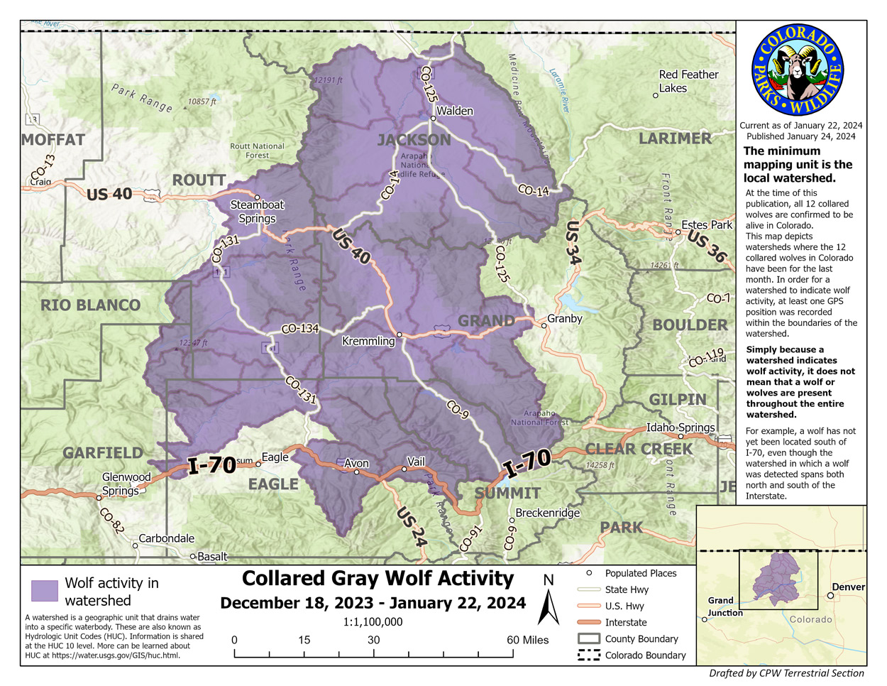

Colorado Parks and Wildlife announced yesterday that they have created a new tool to provide information to the public on the activity of the gray wolves in the state.
The map will help inform the public, recreationists, and livestock producers on where wolves have been in the past month. The map will be updated monthly, reflecting data from the prior month.
Last month, CPW released 10 wolves onto public land in Colorado following a voter-approved initiative that requires the agency to introduce the animals onto the landscape.
The agency said the GPS collars are programmed to record a position every four hours. Staff can see where the wolves have been but cannot tell where they are at a given time, nor can they predict where they will go.