


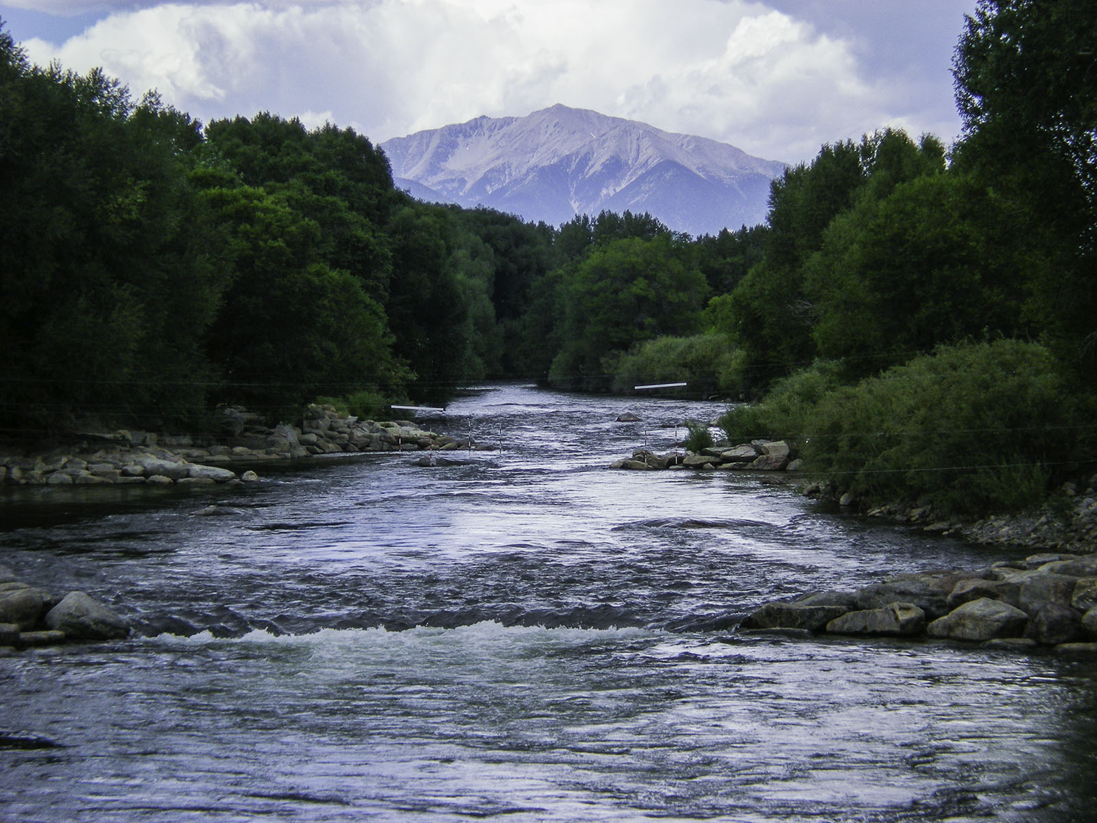

In its weekly River Report, the Arkansas River Watershed Collaborative reports that the Bureau of Reclamation is releasing Fryingpan-Arkansas Project water to support recreational boating on the upper Arkansas River.
As part of the Voluntary Flow Management Program, the Bureau releases Project water from Twin Lakes to maintain a river flow of 700 cfs at the Wellsville gauge south of Salida. By supplementing river flows from July 1 to Aug 15, the VFMP ensures an extended boating season on the river.
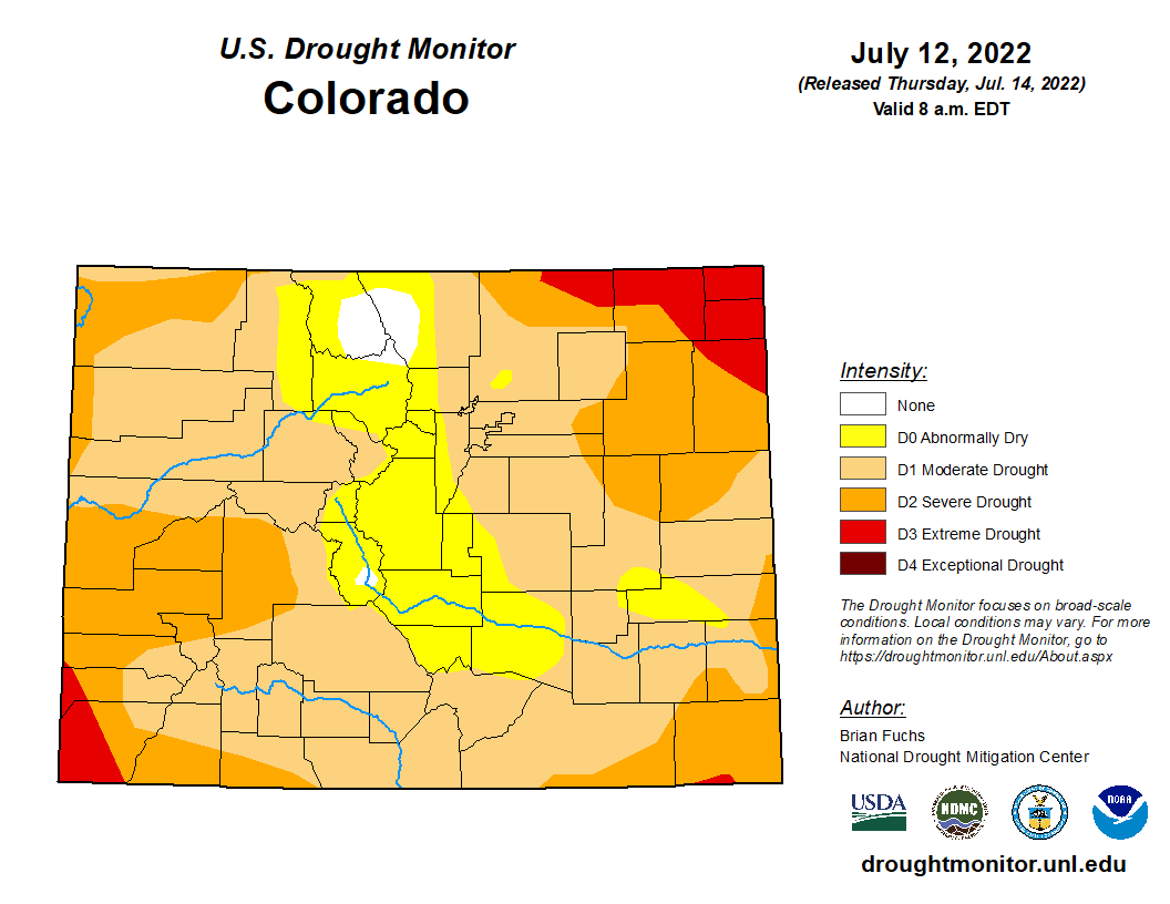
Rainfall continues to ease drought conditions across the Arkansas Basin, with extreme drought lingering in only a sliver of southern Baca County, according to the latest U.S. Drought Monitor report.
The Drought Monitor shows severe drought continuing along the southern and eastern edges of the basin with about half the basin experiencing moderate drought. Most of the Front Range and Upper Basin is now categorized as abnormally dry, and a portion of southern Chaffee County is no longer experiencing drought.
Precipitation
CoCoRaHS, the Community Collaborative Rain, Hail and Snow Network, reports the following precipitation amounts for the past week:
- Leadville – 0.29 inch.
- Buena Vista – 0.24-0.58 inch.
- Salida – 0.12-0.38 inch.
- Westcliffe – 0.37-0.89 inch.
- Cañon City – 0.10-0.15 inch.
- Walsenburg – 0.15-1.37 inches.
- Trinidad – 0.46-1.42 inches.
- Pueblo – 0.25-1.07 inches.
- Colorado Springs – 0.09-0.55 inch.
- Rocky Ford – 0.17-0.21 inch.
- Pritchett – 0.06 inch.
- Lamar – 0.07-0.50 inch.
Reservoir Storage
U.S. Bureau of Reclamation reservoir data shows Pueblo Reservoir water storage decreased to 187,781 acre-feet, 58.1% full. Water storage in Turquoise Lake remains virtually unchanged since last week at 110,592 acre-feet or 85.5% full.
Twin Lakes storage decreased to 112,820 acre-feet, or 80.0% full, as the Bureau has begun releasing Fry-Ark Project water in support of the VFMP. According to the U.S. Army Corps of Engineers, water stored in John Martin Reservoir dropped to 18,004 acre-feet.
River Flows
Arkansas River flows near Leadville dropped to 65.5 cfs this week, while flows below Granite decreased to 430 cfs before climbing to 495 cfs. Flows at the Wellsville gauge are at the VFMP target of 700 cfs.
Flows at Cañon City have decreased to 553 cfs and are 630 cfs below Pueblo Dam. Lower Ark Basin gauges are reporting 831 cfs near Avondale, 230 cfs near Rocky Ford, 120 cfs below John Martin Reservoir and 118 cfs at Lamar.
River Calls
The basin again has 16 calling water rights. In addition to the Arkansas River Compact call, calling rights on the mainstem are the Catlin Canal (1884 priority), the Lamar Canal (1886) and the X-Y Irrigating Ditch (1889).
The most senior calling water rights remain the Titsworth Ditch (1863) on Fourmile Creek, the Model Ditch (1865) on the Purgatoire River and the Hayden Supply Ditch (1866) on Greenhorn Creek.
Additional calling water rights include the Baxter Pioneer Ditch (1866) on the Huerfano River, the Gonzales Ditch (1866) on the Apishapa River, the Coleman Ditch (1867) on Hardscrabble Creek and the Cottonwood and Maxwell Ditch (1874) on Cottonwood Creek.
Other calls are for the Marmaduke Ditch (1878) on Stout Creek, the Dotson Ditch No. 1 (1881) on the St. Charles River, the Hoosier Ditch (1882) on the North Fork of the South Arkansas River, the Missouri Park Ditch (1882) on the South Ark River, the Lake Mirriam Ditch (1884) on the Cucharas River and the Welton Ditch (1889) on the Huerfano River.