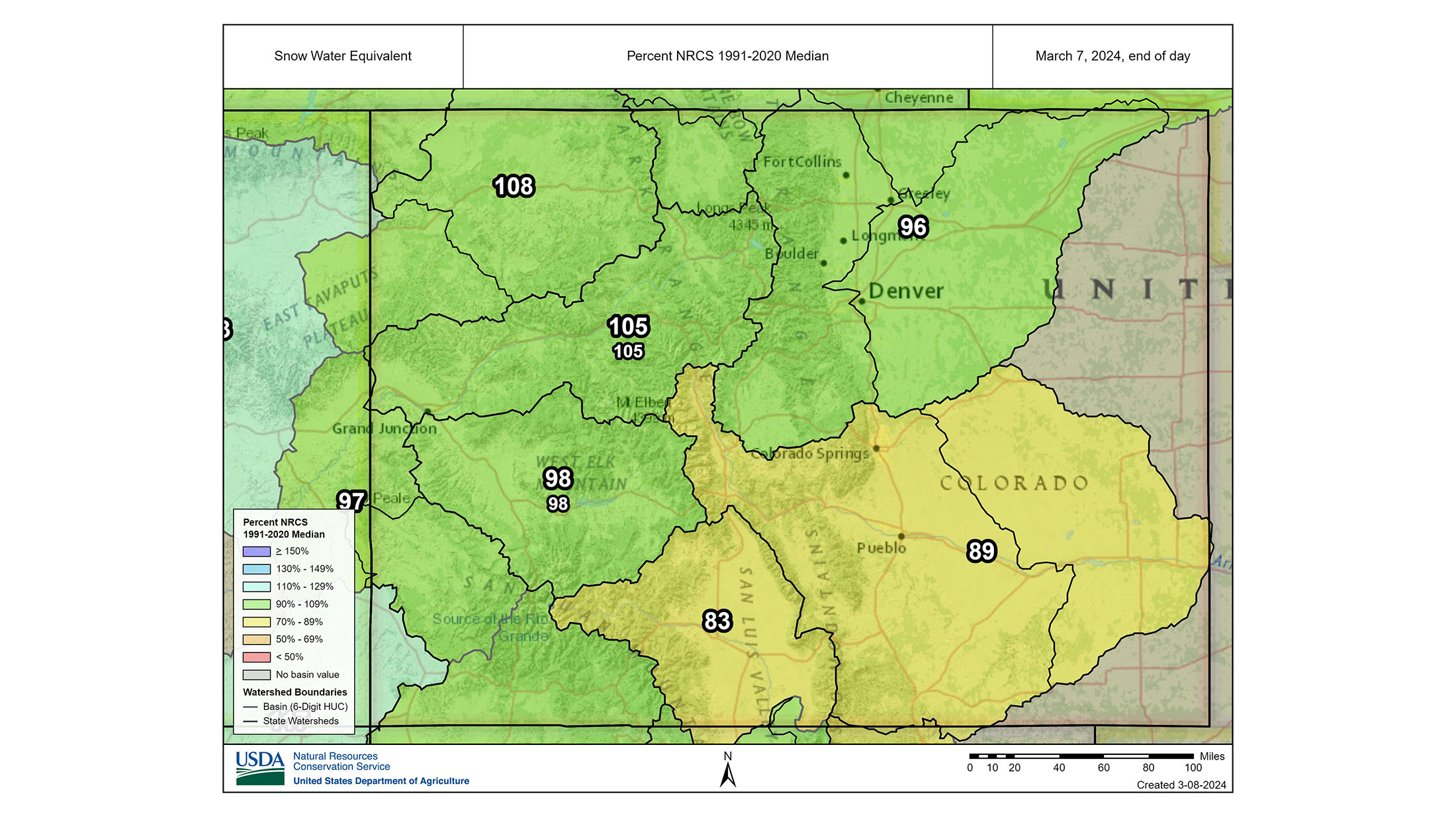
The Arkansas River Watershed Collaborative’s February River Report compiles a wealth of water information for the Arkansas River Basin, including snowpack levels, water-storage data, river flows and calling water rights.
The report says 67 percent of Colorado is currently free from drought conditions, including almost the entire Arkansas River Basin, and Ark Basin snowpack is at 89% of median. The National Weather Service three-month outlook projects “equal chances” of normal temperatures and precipitation through May for the entire state.
Snowpack
The Natural Resources Conservation Service’s Snowpack Telemetry (SNOTEL) stations around the Arkansas Basin report snowpack ranging from 55% of median at Medano Pass in the Sangre de Cristo Range to 159% at Glen Cove near Pikes Peak. Additional SNOTEL readings (reported as snow-water equivalent) are:
- 118% at Porphyry Creek just west of Monarch Pass.
- 109% at Saint Elmo in western Chaffee County.
- 109% at Brumley near Independence Pass.
- 101% at Buckskin Joe in the Mosquito Range.
- 83% at Apishapa near the Spanish Peaks.
- 79% at South Colony in the Sangre de Cristo Range.
- 70% at Hayden Pass near the north end of the Sangre de Cristos.
- 69% at Whiskey Creek west of Trinidad.
Winter Water Storage Program
With the Winter Water Storage Program ending March 14, releases of winter water will begin soon. The program was created during the early planning stages of the Fryingpan-Arkansas Project to store water that would otherwise be diverted by irrigators downstream from Pueblo Reservoir during the winter months.
Participants in the program primarily store their WWSP water in Pueblo Reservoir as well as smaller reservoirs downstream from Pueblo.
Reservoir Storage
Data provided by the Bureau of Reclamation indicates Pueblo Reservoir, at 78.7 % full, currently stores 254,290 acre-feet of water compared to 217,442 acre-feet at he end of February 2023.
At 60.5% full, Turquoise Lake currently impounds 78,306 acre-feet of water compared to 63,949.2 acre-feet a year ago.
Twin Lakes Reservoir, at 72.5% full, holds 102,200 acre-feet of water compared to 100,473 acre-feet acre-feet at this time last year.
The U.S. Army Corps of Engineers reports water storage in John Martin Reservoir at 52,454 acre-feet, slightly less than the 35,423 acre-feet recorded a year ago.
River Flows
As is typical for late winter, Arkansas River flows are relatively low right now, and gauges near the headwaters are providing intermittent readings. The Leadville gauge currently reports 16.7 cfs. The gauge below Granite currently reads 38 cfs.
River flow at Wellsville is 264 cfs, within the target range for the Voluntary Flow Management Program. The Cañon City gauge reads 322 cfs. The flow below Pueblo Reservoir, 86 cfs, will begin to increase as the WWSP comes to an end for this season.
The gauge near Avondale currently reads 349 cfs, while the gauge near Rocky Ford reads 254 cfs. River flow below John Martin Reservoir is currently 0.77 cfs, and the flow near Lamar is at 12 cfs.
Calling Water Rights
Only seven water rights are currently calling for water in the Arkansas Basin, along with two authorized diversions.
The most senior calling right is the Baca Irrigating Ditch with an 1861 priority date on the Purgatoire River.
The 1864 Francisco-Daigre Mill right on the Cuchara River is next in priority, followed by the 1867 Garcia Ditch No. 2 on the Huerfano River and the 1868 Widderfield Combined right on the Apishapa River.
The Reece Ditch, with an 1869 priority date, is calling for water on Hardscrabble Creek, and the 1910 Fort Lyon Storage Canal has a call on the Arkansas River mainstem.
As always there is a 1949-priority call on the mainstem at the Kansas state line under the Arkansas River Compact.
The two authorized diversions are Bison Park Reservoir (1911 priority date on the East Fork of West Beaver Creek) and the New Salida Ditch (1912, on the Arkansas River mainstem).


