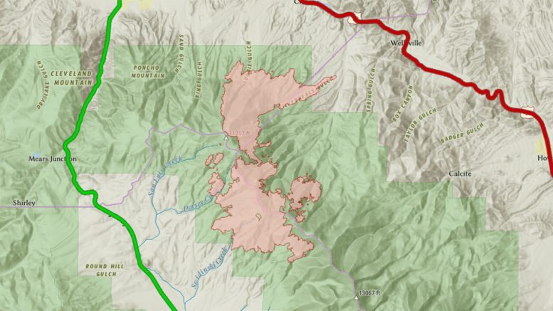
The Decker Fire Team just released a new interactive map that shows the fire’s perimeter.
The map reflects the current fire perimeter for the Decker Fire. This perimeter is updated once daily and is based on infrared flights that typically happen overnight. This perimeter does not have real time updates.

Broadcasting has been my passion for 25+ years. I have recorded extensively for radio, TV, audiobooks, games, apps, podcasts, and documentaries. I know the truth about the One Ring, how to gank a demon, the Doctor’s name, and the Death Star’s only weakness. I am a father, writer, and award-winning broadcaster.
Latest posts by Terry West (see all)
- Sunday, January 21st Weather - January 21, 2024
- Saturday, January 20th Weather - January 20, 2024
- Ark-Valley Humane Society Pet of the Week: Azula - January 17, 2024

Be the first to comment on "Interactive Decker Fire Map Released"